Actual water withdrawal
Please, select a year:
- Vegetation
- Non-vegetation
2023-2024 2022-2023 2021-2022 2020-2021 2019-2020 2018-2019 2017-2018 2016-2017 2015-2016 2014-2015 2013-2014 2012-2013 2011-2012 2010-2011 2009-2010 2008-2009 2007-2008 2006-2007 2005-2006 2004-2005 2003-2004 2002-2003 2001-2002 2000-2001 1999-2000 1998-1999 1997-1998 1996-1997 1995-1996 1994-1995 1993-1994
Tables with data will open in a new window
Source: BWO “Amudarya”
General information about basin
Water management infrastructure
Knowledge baseMaps
Maps
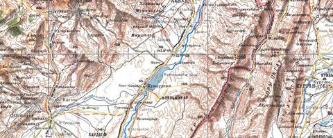
Planning zones in middle stream of the Amudarya river basin: Surkhandarya province, Uzbekistan
Database
The collector-drainage flow from Surkhandarya province
Additional
The Surkhandarya River in Uzbekistan is the right tributary of the Amudarya River.
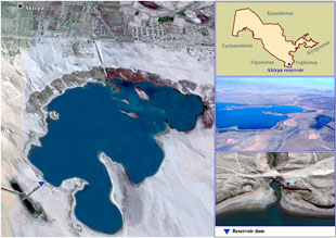
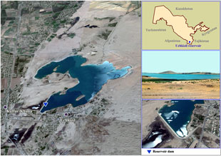
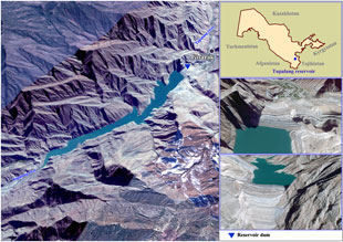
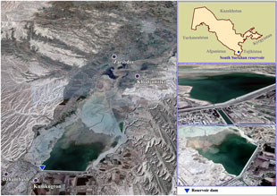
It is formed by the confluence of the Tupalangdarya and Karatag Rivers flowing from the southern slope of the Hissar Mountain. The left tributary of the Surkhandarya, the Karatag River, is located in Tajikistan. The length of the Surkhandarya River is 175 km (287 km from the Karatag River mouth); basin area is 13,500 km2. High-water season is from June to August. At 6 km from the mouth (Manguzar section), average water discharge is 65.8 m3/s. Water is used for irrigation. The Tupalang, South Surkhan, Aktepa, and Uchkyzyl reservoirs are located on the river.
Main tributaries are Sangardak and Khalkadjar (on the right). They are fed with snow and rain waters. High-water season is from March to July; the maximum flow is in May. Salinity (hydrocarbonate-calcium type) is increased downstream, and in the mouth it is 1 g/l during low-water season.
The Surkhandarya oasis is a depression surrounded by highlands on the west, north, and east and the largest Amudarya River on the south. Its main water courses are the Surkhandarya and Sherabad rivers. They flow from north to south into the Amudarya, and thus form the Surkhan-Sherabad basin. The Surkhan-Sherabad valley starts at the foot of the Hissar Mountain on the north and north-east and has the form of a narrow valley. Then it gradually lowers and becomes broader to the south to the Amudarya River. It is surrounded by the branches of the Hissar Mountain on the east, north, and west, which protect the valley from northern cold air mass. Whereas, southern and south-western parts of the Surkhandarya province are open for tropical air mass. These orographic features determine nature and climate conditions typical for this area.
The area of province is 20.1 thousand km (4.48% of the total area of the Republic of Uzbekistan). It borders with the Republic of Tajikistan on the north and north-east, Afghanistan on the south (the border stretches along the Amudarya), and Turkmenistan on the south and west. The province is divided into 13 administrative districts, namely Denau, Saryasiya, Uzun, Altynsay, Shurchi, Baysun, Kumkurgan, Djarkurgan, Termez, Angor, Sherabad, Kyzyryk, and Muzrabad. Termez city is the administrative center.
The vast mountain range stretches up to the borders with Tajikistan. It is split with tributaries of the Tupalangdarya: Duoba, Shatrut (Shakhturud), Tamshush, Khovat, Kshtut (Kishtut). The highest point of the Republic, the Uzbekistan pike or former XXII Congress of the CPSU pike (4,688 m above sea), is located in this part of the Hissar mountain in the Saryasiya district, upstream of Tupalangdarya’s tributaries – Kshtut and Bodamistan. While the pike itself is located at the Uzbek-Tajik border, however this section of the Hissar Mountain (basins of the Tupalangdarya and left tributaries of the Aksu River) is the highest in Uzbekistan, with huge number of mountain pikes exceeding 4,000 m. There are just a few: Khodjapiryakh (4,425 m), Zagrakh (4,333 m), Gava (4,153 m), Khodjakarshavar (4,302 m), Karaduklysh (4,101 m), Kulikapon (4,214 m), Chedyr (or Chedyrsan – 4,411 m), and Khazarkhana (4,450 m).
Graphs
Aktepa reservoir
Dynamics of inflow to the reservoir during the growing and non-growing seasons
Dynamics of water releases from the reservoir during the growing and non-growing seasons
Uchkizil reservoir
Dynamics of inflow to the reservoir during the growing and non-growing seasons
Dynamics of water releases from the reservoir during the growing and non-growing seasons

